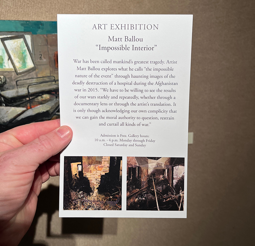
I’ve got a group of works on display at William Woods University in Fulton, Missouri. The show runs through October 6th, and I’ll be giving a talk that evening. For a preview, look below.
This is the third time I’ve shown this body of work, and I’d like to get the chance to show it again. The subject of the work – a “friendly-fire” bombing of a Doctors Without Borders hospital in Kunduz, Afghanistan. If you’d like to see more about this situation, check out my writing about it here.
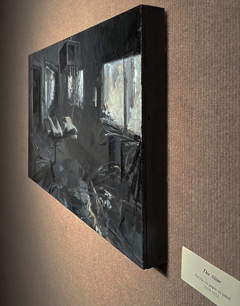
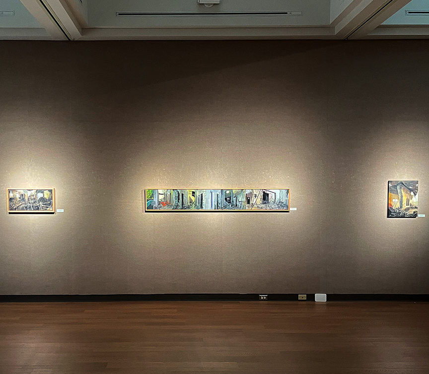
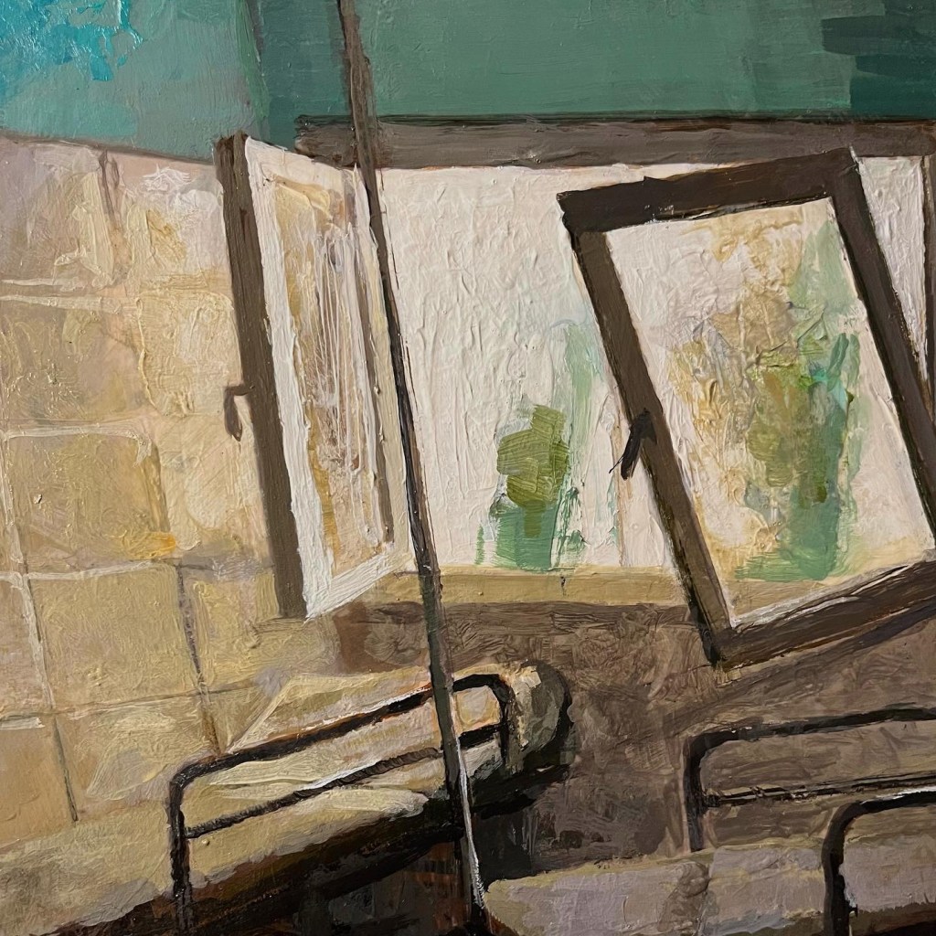
The card for the exhibition.Back of the card with description of the show.Here are just a few of the works on display, along with some details. There’s a lot to see, so come on by!
I’m also pleased to have a small group of my collaborations with Joel T Dugan also on display at the gallery. These Phoneme works are some of my favorites, and there are a number of just finished works included.
Many years ago, my Cousin Chris and I were constant companions in the woods around Camden, NY. In particular, we explored the region between our homes. His place was several miles away to the west if you took the old dirt road that emerged onto the highway 50 yards from the house I grew up. We also did a lot of camping and hiking in the woods east of my own home.
Here’s what that area looks like today (well, a few years ago via Google Earth):
I grew up along Route 70 – Wolcott Hill Road – about two miles from the town of Camden. Wolcott Hill Road runs roughly South to North away from Camden, so this view is oriented with East at the top and West at the bottom. You can see the small lake in the lower half of the image; that is a reservoir, and part of Camden’s waterworks system. If you were to walk due West from the South corner of the reservoir, you’d come out on Wolcott Hill Road right next to my childhood home.
From the ages of 12 to 16 or so, I started making maps of our haunts out in this section of land. When I was 19, I decided to make a larger, more refined version of the map, bringing together all of the various places we used to camp and hunt. The result is below.
Watercolor map of area around my home. 24×22 inches. 1996.
There are some obvious mistakes of guesstimation here, most glaringly in the position of Route 85, which we locals know as Skinner Settlement Road. There is also some distortion of the placement of various fields, and a bit of miscalculation of distances, but I’m pretty pleased with my effort since I did not use any proper map as a source.
There are some great memories here.
At Winter’s Night, we camped in -2° weather. In the morning, we were lying in impressions in the hard snow caused by our heat coming through the tent.
At Cowadunga, we cooked venison in beer and used hard, flat cow poop for fuel – hence the name we gave the place.
The Reservoir Cabin Site was a special spot, and we stayed there quite a few times.
One night, at View, we had amazing, super clear skies all night long. It seemed as if we could see forever.
Though we never camped at Lone Tree Hill, we often climbed the massive maple there.
At Earthview we had one of our strangest camping trips ever, when we were accosted by a large number of Woodland Jumping Mice. What seemed like dozens of them came through our area, but the issue was that this was in the wee hours of the morning, so it was very dark, and the rhythm of their jumps through the underbrush sounded like footsteps. Pretty wild.
I’m glad I made documents like this throughout my teenage years. Though most are in a more rough or not so presentable state, they represent my attention to and interest in my surroundings and experiences. I’m glad to have them.


